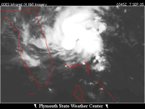
OPHELIA NOW A HURRICANE
9/6/2005 12:11:24 PM Pacific Standard Time
Kent,
What
we witnessing is the
manufactured development
of
Ophelia. Watch it closely as this will become the next shot across
the state Florida in this continuing war in the
skies. A very real potential
is present for this storm to track slowly (2-6 mph) southwestward across
Florida then re-curve toward the west then north similar to Katrina but with
a track farther to the east. This
would unfold over the next six days.
An additional thunderstorm
complex presently south of the Gulf Coast will bear a close watch as well;
not so much as a tropical storm , although it would be foolish to rule out
that possibility, but mostly in its potential as a very heavy rain
maker.
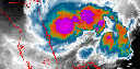
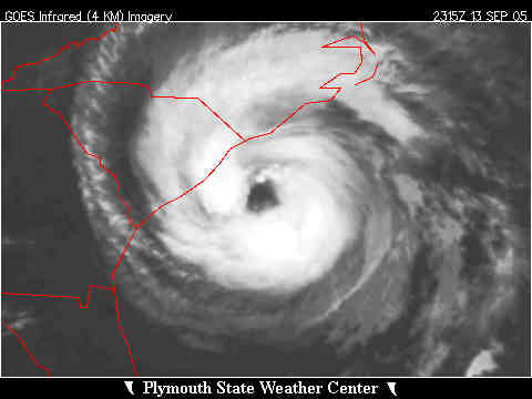
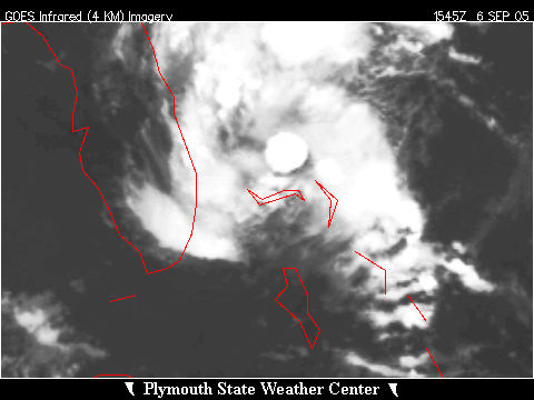
That one solo cell in that IR image
off the coast of Florida is a thunderstorm top that is very tall and as a
result is very cold. Tops that
bright run about –80 degrees C.
Tops this cold begin to develop incredible updrafts drawing atmosphere
in from below and thus beginning the inflowing of air and the resultant
circulation that becomes a tropical
storm. The frequency and persistence
of these towers will largely determine how quickly and how large a storm
Ophelia becomes. I
wouldn’t want to live in Florida right
now.
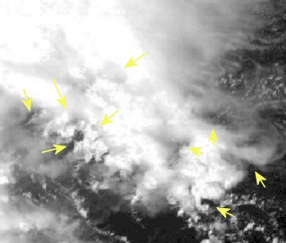
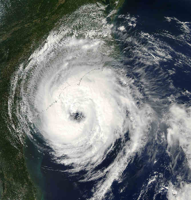
Attached is visible image from Ophelia
at 11:15AM Pacific time… The
cloud tops are bright/washed out as the sun is
overhead.
I see many anchoring holes, which are conduits for energy that will be used to develop many intense thunderstorm cells as Ophelia strengthens further today.
--Scott
Stevens
Source:
http://vortex.plymouth.edu/hur_dir/hurr_nt1.gif Kent Steadman |
|
MORE NOTES
9/6/2005 10:42:25 AM Pacific Standard Time
http://www.goes.noaa.gov/GSSLOOPS/ecwv.html
Depending on overnight status:
wed forcast map:
Probably not enough time to develop much before being pushed into Texas, unless it sits out there. I have been wrong before, but I am not so sure #sixteen is going north (off Florida). Sixteen has been sitting there for two days already and rotating rain onto Florida all that time.
Will be watching
ADDED:
Looks to me like circulation. I am thinking lower Gulf:
http://www.ssd.noaa.gov/PS/TROP/DATA/RT/gmex-ir4-loop.html
http://www.goes.noaa.gov/GSSLOOPS/ecwv.html
ADDED
Look at this...six day map from NOAA
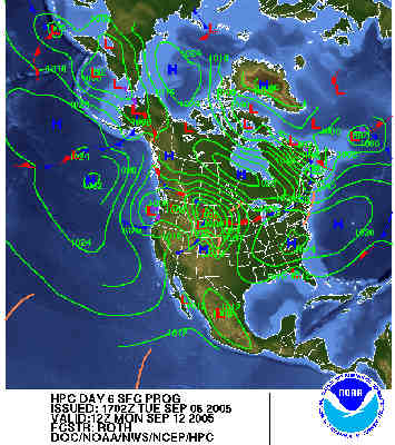
Does this mean NOAA is expecting this storm to cross over Florida and go west along the coast? Looks like, at this time sept6th, that is what they think will happen on sept 12th (monday next). That means the high pressure would be expected to stay in place to the storm's north (pushing it westward along the coast).
Source:
http://www.ih2000.net/ira/bmt-wth.htm
Models, early guidance
http://euler.atmos.colostate.edu/~vigh/guidance/atlantic/early1.png
9/7/2005 4:13:05 AM Pacific Standard Time
Kent, I am new to the "holes" thing and "anchoring" storms, but is this what is going on in the water vapor loop on one storm, and the infared in the other storm. I don't know, I am just wondering:
water vapor:
http://www.goes.noaa.gov/GSSLOOPS/ecwv.html
http://www.ssd.noaa.gov/PS/TROP/DATA/RT/gmex-ir4-loop.html
This is 6:00am Texas time
Vortex still showing on IR late last night
9/7/2005 7:12:00 AM Pacific Standard Time
Computer models sometimes have large errors, but I see more showing the storm coming into the Gulf this morning. Five now on this one:
http://euler.atmos.colostate.edu/~vigh/guidance/atlantic/early1.png
http://www.wunderground.com/tropical/tracking/at200516_model.html
http://www.sfwmd.gov/org/omd/ops/weather/plots/storm_16.gif
 |
9/14/2005 7:58:37 PM Pacific Standard Time
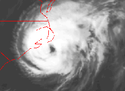
Hi Kent, Don't know if you've observed this , but the latest NASA image of Ophelia shows a storm with a SQUARE eye!! There are distinct right angles easily seen when the image is enlarged. Am I correct to presume that this does not typically occur in nature? I saved a copy on my hard drive and will forward the image to you, if the link doesn't work. |
9/14/2005 10:15:31 PM Pacific Standard Time
I was looking at this animated gif and thought it odd. It was from a weather blog posted a few minutes ago. It looked strange to see these spokes in the eye. Thoughts?
http://www.wunderground.com/blog/JeffMasters/show.html
 |
9/14/2005 11:43:25 PM Pacific Standard Time
Hi Kent, Not a square eye, is eye of Horus. If you read that last page I wrote years ago when we put up my work, the eye of horus had to return...it has as of yesterday. I love Egypt and don't want to leave, but alas I head for home tomorrow :( |
9/15/2005 1:51:55 AM Pacific Standard Time
KENT YESTERDAY, THE SKIES HERE IN VA BEACH, WERE BEING SPRAYED THE MOST ANY OF US HAVE EVERY SEEN, IT WAS UNREAL, I THINK I KNOW WHY OPHELIA IS NOT MOVING, PEOPLE HERE ARE FEELING SMALL SHOTS OF ELECTRICY SHOCKING THEM,
 |
|
Thousands of pages. Recent
![]()
![]()
![]()
![]()