http://ida.wr.usgs.gov/html/m00010/m0001080.html
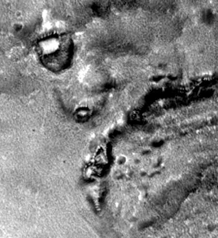
The NASA geologists describe this generically as "fretted terrain with crater ejecta," but to me it resembles lava flows or the deformation of rock due to intense heat. Could it be the result of a global nuclear holocaust?
Acquisition parameters
Image ID (picno): M00-01080 Image start time: 1999-04-08T05:07:38.88 SCET Image width: 512 pixels Image height: 6528 pixels Line integration time: 0.4821 millisec Pixel aspect ratio: 0.94 Crosstrack summing: 4 Downtrack summing: 4 Compression type: MOC-PRED-X-5 Gain mode: 0A (hexadecimal) Offset mode: 24 (decimal) |
Derived values
Longitude of image center: 336.61°W Latitude of image center: 42.51°N Scaled pixel width: 6.16 meters Scaled image width: 3.16 km Scaled image height: 37.91 km Solar longitude (Ls): 121.20° Local True Solar Time: 14.26 decimal hours Emission angle: 0.23° Incidence angle: 35.39° Phase angle: 35.29° North azimuth: 93.99° Sun azimuth: 338.04° Spacecraft altitude: 411.81 km Slant distance: 411.81 km |
| Parameters for MOC Standard Data Product m0001080 | ||||||||||||||||||||||||||||||||||||||||||
|---|---|---|---|---|---|---|---|---|---|---|---|---|---|---|---|---|---|---|---|---|---|---|---|---|---|---|---|---|---|---|---|---|---|---|---|---|---|---|---|---|---|---|
|
|
|
||||||||||||||||||||||||||||||||||||||||
| Image Description: Crater ejecta and fretted terrain apron |
||||||||||||||||||||||||||||||||||||||||||